Jamaica Road-Trip Planning: Routes, Stops & Timing
Jamaica Road-Trip Planning: Routes, Stops & Timing
There is a particular pleasure in leaving Jamaica’s all-inclusive resorts behind and setting out across the island under your own steam. The road winds through parishes where sugar-cane fields stretch towards the hills, roadside vendors tend their stalls beneath the trees, and the Caribbean Sea appears between bends when you least expect it. On the South Coast, the pace of life shifts, and a journey through St. Elizabeth can feel a world away from the resort strips of Montego Bay and Negril.
A Jamaican road trip rewards patience more than speed. Distances on the map can look deceptively short, particularly when a route leaves the main highway for a winding country road. If YS Falls is on your itinerary, leave generous room for the drive, a proper swim in the cool spring water, and a leisurely stop for something freshly cooked along the way. A little breathing space makes all the difference.
For official visitor guidance before setting off, consult Visit Jamaica’s vehicle rental and transportation guide. It is a useful starting point for understanding the island’s driving arrangements and rental requirements.
The Realities of Driving in Jamaica
Jamaica drives on the left, with the steering wheel on the right-hand side of the car. If you are arriving from the UK, that part will feel familiar; visitors from the United States, Canada and much of continental Europe may need a little time to settle into the rhythm. Roundabouts, junctions and narrow village streets deserve particular attention during those first few hours.
Driving here calls for a more measured approach than a motorway journey at home. Route taxis can move assertively, pedestrians may step into the road, and livestock occasionally wander onto rural stretches. Potholes vary from minor surface damage to deep craters capable of damaging a tyre or suspension. Keep your speed sensible and leave enough room to react when the road changes unexpectedly.
Town speed limits are generally around 50 km/h (30 mph), while open rural roads commonly carry an 80 km/h (50 mph) limit. Modern toll highways, including parts of Highway 2000, have higher limits, with some sections reaching 110 km/h (about 68 mph). Always follow the posted signs, as limits and road conditions vary.
My advice is to give yourself the first morning to get comfortable with the car. Take the quieter roads slowly, keep your eyes well ahead, and resist the temptation to make up lost time after a traffic delay.
Choosing the Right Rental Car
The car you choose shapes the sort of journey you can comfortably make. A compact automatic is often a sensible choice for couples or small families sticking mainly to paved roads, while a vehicle with greater ground clearance can make rougher rural stretches less stressful. You do not need a large four-wheel-drive vehicle for every South Coast itinerary, but a very low-slung car can be an awkward companion on damaged roads.
Compact Car or Sedan
A compact automatic is easy to handle in towns and economical for a road trip with modest luggage. A standard sedan adds boot space for longer stays, although its lower clearance calls for extra care on rough surfaces.
- Suitable for paved main roads and urban driving.
- Usually easier to park in busy town centres.
- Check boot space before travelling with several large suitcases.
- Approach potholes and steep entrances cautiously.
Higher-Clearance Vehicle
A small SUV or similar vehicle can make uneven rural roads more manageable, particularly when your itinerary includes several inland stops. The extra clearance is useful, though it does not make every track suitable for ordinary rental driving.
- Useful for routes with rougher paved sections.
- Can accommodate larger luggage loads.
- Check the rental agreement before taking any unpaved road.
- Allow for higher fuel consumption and rental costs.
Choose a vehicle that suits the actual route rather than the most adventurous version of the trip you might imagine. If your plans include a remote guesthouse, ask the property about the final approach before booking a car.
Decoding Jamaica’s Road Network
Jamaica’s road network uses lettered classifications that help you understand the broad shape of a journey. A-roads are primary routes connecting major towns and cities, while B-roads are secondary routes that often lead into smaller communities and the rural interior.
The A1 runs along parts of the island’s northern corridor, while the A2 follows much of the southern route through communities including Spanish Town, Mandeville and Black River. The A3 connects the St Andrew area with communities in the north, while the A4 runs east from Kingston through St Thomas and Portland. These roads can be useful anchors when planning a longer loop, but the quality of the surface and the speed of travel still vary considerably.
Secondary roads can be particularly scenic, winding past small farms and villages where the landscape changes with every bend. They can also be slow. A road that looks direct on a map may involve steep gradients, narrow sections or damaged tarmac that requires careful driving.
In Jamaica, the distance between two places tells only part of the story. The road itself sets the pace.
Use GPS estimates as a starting point, then add time for traffic, roadworks, fuel and unplanned stops. On a winding rural stretch, even a short distance can take considerably longer than expected. A sensible buffer is especially important when you have a timed attraction booking or need to return to your accommodation before dark.
Vehicle Logistics and Documents
Before collecting a rental car, check the licence rules that apply to your nationality and the conditions set by the rental company. Many visitors can drive using a valid foreign licence for a limited period, but the permitted duration and documentation requirements vary. UK licence holders may have different allowances from visitors holding licences issued elsewhere, so confirm the current rules rather than relying on an old travel forum post.
Most major rental categories have a minimum driver age of around 25, although the exact threshold depends on the company and vehicle. Younger drivers may face restrictions or additional charges. Read the rental agreement carefully before paying a deposit.
- Carry your physical, valid driving licence and passport or other requested identification.
- Check the insurance excess, deposit hold and accepted payment cards.
- Confirm whether additional drivers need to be registered.
- Inspect the tyres, lights, windscreen and spare equipment before leaving the depot.
- Photograph existing scratches, dents and other damage.
- Check the fuel policy, mileage terms and roadside assistance arrangements.
- Ask whether the rental agreement restricts travel on particular roads.
For additional visitor guidance, read Visit Jamaica’s general travel information. Rental terms are company-specific, so the agreement you sign remains the key document for your particular vehicle.
Road-Trip Logistics Checklist
| Item | What to check | Why it matters |
|---|---|---|
| Driving licence | Carry the physical, valid licence and confirm local requirements. | Required documentation for driving and rental collection. |
| Rental agreement | Review insurance, deposit and fuel terms. | Helps avoid unexpected charges. |
| Payment | Carry a usable payment card and some Jamaican dollars. | Useful for fuel and smaller roadside purchases. |
| Vehicle | Inspect tyres, lights, spare equipment and existing damage. | Helps identify problems before departure. |
| Navigation | Download offline map areas and save key destinations. | Useful where mobile coverage drops. |
| Fuel | Refuel before longer rural stretches. | Reduces dependence on finding the next station. |
Building South Coast and Cross-Island Routes
A successful Jamaica road trip begins with geography rather than a long list of attractions. The island’s western resort hubs, central uplands and southern coastal communities each have their own character, and moving between them can take longer than the map suggests.
For travellers staying in Negril, a journey east towards St. Elizabeth can combine countryside views with a stop at YS Falls or a visit to the Black River area. Those beginning in Montego Bay can plan a wider loop through the western parishes before continuing towards the South Coast. Travellers starting in Kingston may prefer to cross the island through the central highlands or use a major highway for part of the journey, depending on their other stops.
Try to keep each day’s driving within a manageable window. A route with one major attraction and a handful of shorter stops is often more rewarding than an itinerary that attempts to cover half the island between breakfast and sunset.
- Western Jamaica: Use Montego Bay or Negril as a base for exploring the west before heading towards St. Elizabeth.
- South Coast: Combine a countryside drive with a visit to YS Falls, then consider Black River or a nearby coastal stop.
- Central Jamaica: Allow additional time for inland routes through the hills and smaller communities.
- Cross-island journey: Choose a realistic overnight stop rather than attempting a long cross-country drive after a full day of sightseeing.
A Sensible Day-Planning Framework
Driving Time
Build your schedule around realistic travel estimates, with extra time for slower roads and traffic near larger towns. A journey that looks straightforward on a map may involve frequent changes in speed.
- Check the route before leaving.
- Allow a buffer for unexpected delays.
- Plan fuel and food stops along the way.
- Avoid relying on a precise arrival time.
Sightseeing Time
Attractions need their own time allowance. A waterfall visit can easily fill a substantial part of the day once you include changing, swimming and walking between viewpoints.
- Choose one main attraction for the day.
- Add only a few nearby stops.
- Leave room for lunch and roadside discoveries.
- Keep the return journey comfortably within daylight hours.
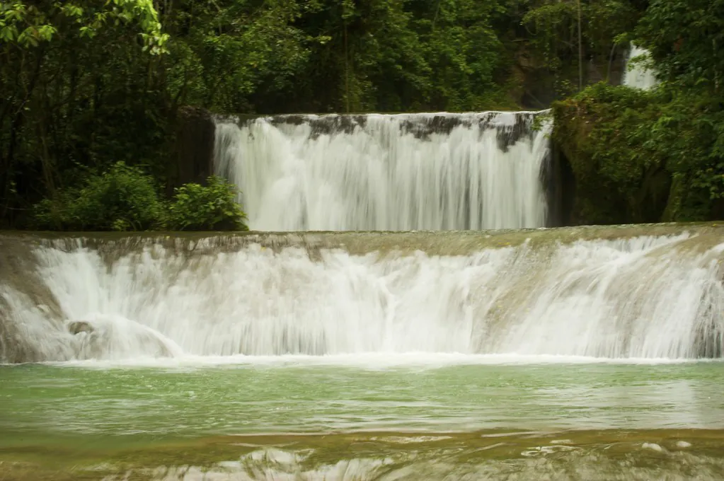
When planning a day around YS Falls, treat the waterfall visit as a substantial part of the itinerary rather than a quick photo stop. The cold spring water can be a welcome break from the heat, and the surrounding grounds invite a slower pace than a tightly timed excursion allows.
Scenic Stops and Cultural Waypoints
One of the pleasures of travelling through St. Elizabeth is the way the landscape opens up as you move inland from the coast. Small settlements, agricultural land and roadside stalls give the journey a character of its own, particularly when you leave enough time to stop without watching the clock.
- Holland Bamboo Avenue: This striking stretch of the A2 near Lacovia is lined with tall bamboo that arches over the road in places. Drive slowly, keep an eye out for other vehicles and avoid stopping where it would obstruct traffic.
- Middle Quarters: Known for its roadside vendors selling peppered shrimp, this community is a memorable place to pause for a local snack. Carry Jamaican cash, as payment arrangements vary between stalls.
- Appleton Estate: The estate in the Nassau Valley offers a different perspective on Jamaica’s sugar and rum heritage. Check the official visitor information and book ahead if you want to join a tour.
For visitor details, consult Appleton Estate’s official visitor information. A planned stop here can work well as part of a wider South Coast itinerary, though the additional drive should be factored into the day’s schedule.
These places are part of living communities, not simply photo opportunities. Buy from local vendors where you can, follow parking instructions and be considerate when taking photographs near homes or businesses.
Fuel, Food and Rest Stops
Fuel is sold by the litre in Jamaica, and major service-station networks include Texaco, Total and Petcom. Stations are easier to find along main routes and around larger towns than on quieter rural roads, so keep an eye on the gauge rather than waiting for the warning light.
Fuel prices change, and the cost of filling a standard sedan depends on the tank size and current pump price. Keep some Jamaican dollars available for rural stops, where cash can be more convenient than relying on a card terminal. On longer journeys, refuelling before leaving a major town is a sensible habit.
- Refuel before heading into less-populated areas.
- Check the opening hours of stations along your intended route.
- Carry cash for small purchases and roadside food.
- Stop for water and a proper meal before fatigue sets in.
- Use designated parking areas and avoid blocking narrow roads.
Food is part of the road-trip experience. A fresh patty from a bakery or a plate of food from a roadside cook can turn a routine break into one of the day’s best memories. Around Middle Quarters, the peppered shrimp stalls are particularly associated with the local area, and the smell of seasoning drifting across the road is hard to miss.
Leave a little room in the schedule for lunch. Some of the loveliest stops happen when you pull over for a bite and discover that the countryside deserves a longer pause.
Navigation Before You Leave
Google Maps and Waze are useful for planning routes across Jamaica’s main road network, but mobile coverage can become unreliable in rural areas and mountain passes. Downloading offline map data before departure is especially helpful when travelling through the interior or around Cockpit Country.
Prepare your route while you have a stable internet connection, and save the destinations you expect to visit. This small bit of preparation can save a good deal of frustration when a signal disappears halfway through a journey.
- Download offline map areas covering your entire route and likely detours.
- Save accommodation addresses and attraction locations in advance.
- Check the route against a second navigation app where practical.
- Take screenshots of key directions and junctions.
- Keep your phone charged and carry a suitable charging cable.
- Ask your accommodation about local road conditions before setting off.
Navigation apps may suggest shortcuts that are unsuitable for your rental vehicle or current weather conditions. If a route appears to lead onto a rough track, stop somewhere safe and reassess rather than following the screen blindly.
Weather and Seasonal Driving
Jamaica’s tropical weather can change the character of a road trip in a matter of minutes. Heavy showers reduce visibility, leave standing water on the road and can expose potholes that were difficult to spot in dry conditions. Rural roads with steep gradients or poor drainage may become particularly challenging after prolonged rainfall.
The island’s wetter periods generally occur around May and October, although rainfall varies by region and year. The Atlantic hurricane season runs from June through November, with the greatest need for close weather monitoring during periods of tropical activity. A forecast is a planning tool, not a guarantee of the conditions you will meet on a particular road.
During heavy rain, slow down and increase your following distance. Avoid driving through floodwater when its depth or the condition of the road beneath it is uncertain, and never assume that a flooded shoulder is safe for pulling over. If visibility deteriorates sharply, find a safe place to stop away from moving traffic and wait for conditions to improve.
Give the weather the final say. If a downpour turns a rural road into a difficult drive, changing your plans is far better than pressing on simply to keep to a timetable.
For seasonal travel context, consult Visit Jamaica’s travel information, and check local forecasts before setting out. After severe weather, confirm that your intended roads and attractions are operating normally rather than relying on an older itinerary.
Build the Route Around Your Actual Stops
A flexible route through western Jamaica and St. Elizabeth can bring together coastal scenery, rural communities and time at YS Falls. Use the map below as a regional planning aid, then check the road conditions and travel estimates for the specific places you intend to visit.
For a broader understanding of the area, our guide to Saint Elizabeth Parish explores the communities and landscapes that give this part of Jamaica its distinctive character.
Bridging the Journey to YS Falls
YS Falls is in St. Elizabeth Parish, in Jamaica’s rural South Coast region, where the journey passes through a landscape of agricultural land and small communities. It fits naturally into a wider road trip, particularly if you are travelling from Negril or exploring the southern side of the island.
For the specific YS Falls direction details, including how to approach the attraction from major visitor bases, use the dedicated transport guide rather than relying on a general island itinerary. Travel times vary with your starting point, traffic and road conditions, so leave a generous margin around your planned arrival.
If you are still putting the day together, the visit-planning hub covers admission information, opening details and practical preparation. River shoes are worth packing if you intend to swim, as the natural pools have rocky areas underfoot and the spring water can feel surprisingly cold after a hot drive.
When a Tour Makes More Sense
Driving yourself gives you control over the pace of the day, but it is not the only way to explore the South Coast. If you would rather leave the driving to someone else, a guided excursion can combine YS Falls with nearby attractions such as Black River or Appleton Estate, depending on the itinerary.
When comparing excursions, check the pickup location, transport arrangements, included admission and the amount of time allocated to each stop. A combination tour may suit travellers who want to see several places in one day, while a more focused visit leaves greater freedom to spend time at the falls.
Leave Room for the Road
A rewarding Jamaican road trip is built on sensible timing rather than a packed list of destinations. Choose a route that suits your driving experience, keep your paperwork and fuel sorted, and download your maps before leaving a reliable connection behind. When the weather turns or a roadside stop catches your eye, give yourself permission to adjust the plan.
On the South Coast, the best part of the day may be the moment you pull into a small roadside stall, hear the leaves shifting overhead and realise there is no need to hurry. Let the journey through St. Elizabeth unfold at its own pace, and save enough time for the cool water at YS Falls to feel like a proper reward.