Jamaica Parish Guide: Understanding Saint Elizabeth
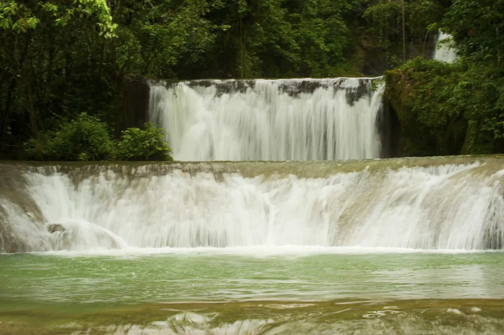
YS Falls is in Saint Elizabeth Parish on Jamaica’s south-west coast, in Cornwall County, roughly 35 kilometres inland from the parish capital at Black River. That single line settles the question travellers type most often about the place, and it is a line most guides bury beneath three paragraphs of scene-setting.
Saint Elizabeth is Jamaica’s second-largest parish by land area and holds close to 150,000 people across country that swings from near-desert scrub in the south to cloud-fed mountain farmland in the north. YS Falls is one of its headline draws, and it works best as a doorway into teh parish rather than the whole room.
The falls themselves have dedicated pages on this site, covering the tractor-jitney ride, the seven tiers and the canopy zipline in proper detail. What follows is the parish around them: how it fits together, where people actually live, what the weather does across the year, and how to slot a morning at the falls into a wider South Coast itinerary.
The Direct Answer: What and Where Saint Elizabeth Is
Jamaica has fourteen parishes grouped into three counties, and Saint Elizabeth belongs to Cornwall in the island’s south-west corner. It borders Westmoreland to the west, Manchester along much of its eastern and north-eastern edge, and touches Trelawny and Saint James up in the hills. Black River is the capital, a low-rise town sitting at the mouth of the river of the same name, and it is where you find the parish council, the courthouse and the sort of unhurried market that tells you most of what you need to know about the pace here.
The parish covers a little over 1,200 square kilometres, which makes it second only to Saint Ann in size. YS Falls St Elizabeth Jamaica is a phrase people search for constantly, and the geographic answer is straightforward: the falls sit in the interior, north of Black River and east of the Santa Cruz Mountains, on land that has belonged to the YS Estate for generations. The river feeding them rises in the hills and runs down through the parish before joining the wider watershed.
| Detail | Saint Elizabeth |
|---|---|
| County | Cornwall |
| Capital | Black River |
| Land area | Roughly 1,212 sq km |
| Population | Approximately 150,000 |
| Main towns | Black River, Santa Cruz, Junction, Malvern, Balaclava, Maggotty, Lacovia |
| Principal river | Black River, the island’s longest navigable watercourse |
| Core industries | Agriculture, alumina, tourism, fishing |
| Signature attraction | YS Falls, plus Black River safari and Treasure Beach |
Why the Parish Name Matters, and Why the Falls Sit Here
The English parish system landed in Jamaica during the 1660s and 1670s, when the colonial administration carved the island into units small enough for a church and a vestry to manage. Saint Elizabeth emerged from that process and took its name from a woman called Elizabeth, with the usual telling crediting the wife of a governor of the period. The parish boundaries have shifted slightly over the centuries, but the shape has held for a long time now.
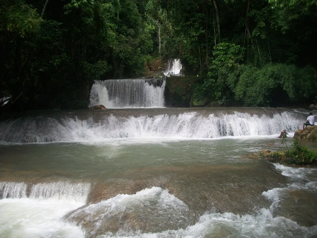
Boundaries matter for the falls because rivers do not care about maps. The YS River collects its water high in the interior and spills down a series of limestone shelves inside Saint Elizabeth’s border, which is why the attraction belongs to this parish and not to Manchester or Westmoreland. Ask anyone working at the gate and they will tell you the same thing. The estate, the pasture you cross on the jitney, and the falls at the end of it are all one piece of land, and all one parish.
Saint Elizabeth does not perform for visitors. It grows things, digs things, cooks things and gets on with it, and that is exactly why the south coast feels nothing like the resort strip.
Two Parishes in One: The Dry South and the Wet North
Drive south from Maggotty towards Black River and the landscape changes under the wheels. The hills give way to flat, pale country dotted with logwood and cactus, and the sky opens up in a way that startles people who arrived expecting rainforest.
The Dry South
The Pedro Plains stretch across the southern belt towards Treasure Beach and the coast. Rainfall here is among the lowest on the island, and the ground shows it: thorn scrub, guinea grass, salt-tolerant plants near the shore. Farmers work around the dry spells with irrigation and careful timing.
Packing note: the south is hot and bright for most of the year. A wide hat and a refillable bottle matter more than a rain jacket between December and April.
The Wet North
Head north and uphill towards Malvern, Balaclava and the Nassau Valley and the rain returns. Cooler air, richer soil, coffee and citrus, and a green that photographs badly because it refuses to look real. The Santa Cruz Mountains catch the moisture that the plains never see.
Packing note: an afternoon shower is normal here in the wet months, and the road up to YS Falls can run slick after heavy rain. River shoes with grip earn their place in the bag.
The Black River and the Great Morass
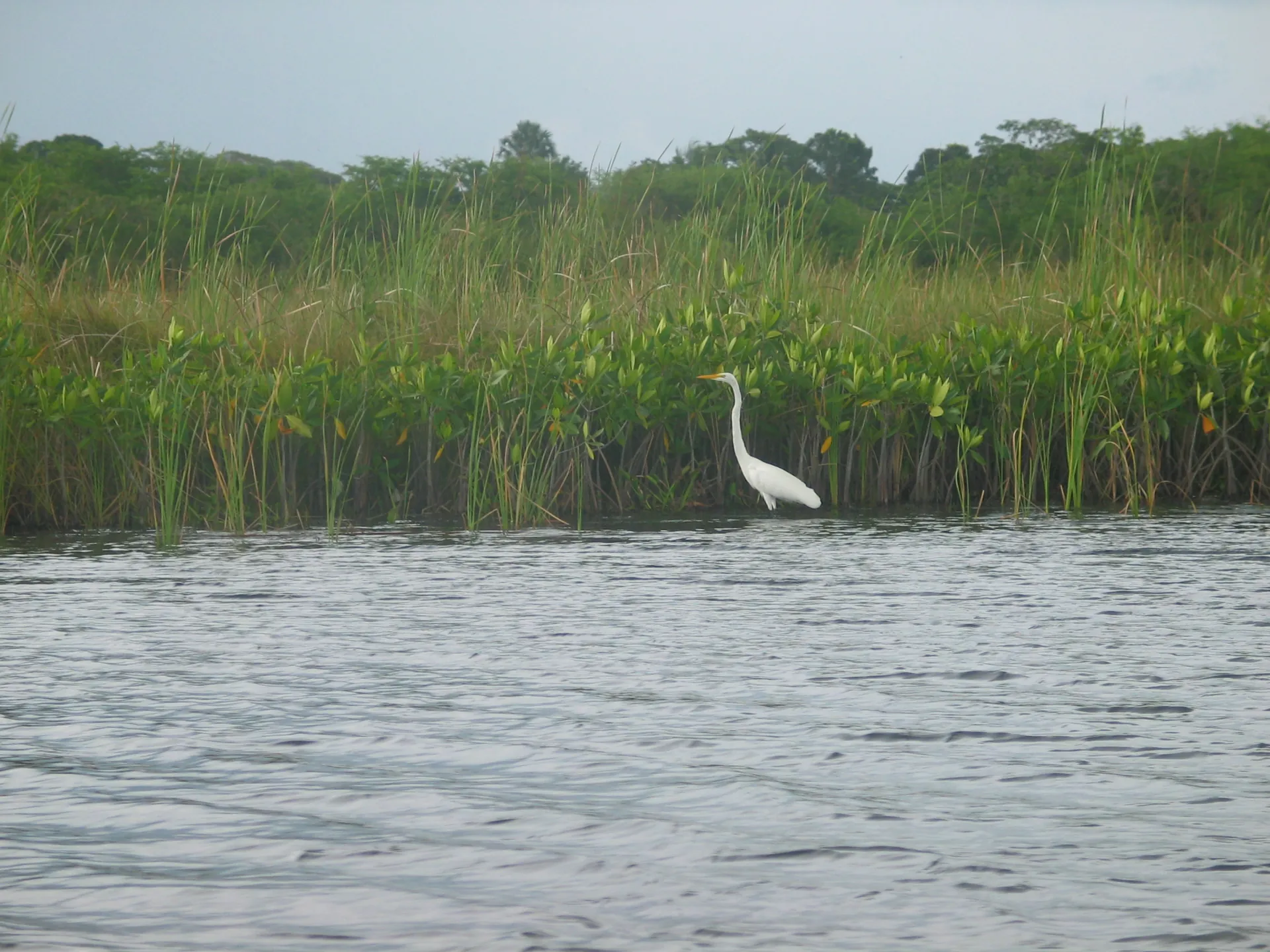
The Black River is the parish’s ecological spine. It is the longest navigable river in Jamaica, and it empties into a wetland known as the Lower Morass, a vast expanse of mangrove, marsh and open water that carries international protection under the Ramsar Convention. Details of that designation sit with the Ramsar Convention Secretariat if you want the paperwork.
American crocodiles live here in numbers, which surprises visitors who assume the safari boats are staging something. They are not. The crocodiles are wild, the birdlife is genuine, and the occasional manatee sighting is a real thing rather than a marketing line. A boat trip up the river is the single easiest way to understand what the parish is made of, and it pairs naturally with a YS Falls morning. The combination is covered in full on our YS Falls and Black River safari page.
Book the river boat for late afternoon if you can. The light goes gold, the boatmen slow down, and the crocodiles come out to warm up on the banks. Morning trips are fine, but they are quieter in every sense.
Local tip, Black River
Towns and Communities Worth Knowing
- Black River — the capital, on the coast, with the river safari jetty and a handful of heritage buildings
- Santa Cruz — market town at the junction of the inland routes, busy on Saturdays
- Junction — crossroads settlement with roadside produce stalls and good jerk
- Lacovia — twin towns either side of the river, home to the famous pepper shrimp stalls
- Malvern — hill country, cooler, with schools and small farms around it
- Maggotty — the closest settlement to YS Falls, and where the sugarcane railway once ran
- Balaclava — small interior town on the road towards the Nassau Valley
- Middle Quarters — the pepper shrimp capital, sold from roadside stands along the Black River road
- Siloah — farming community in the eastern hills
- Nain — home to the alumina refinery that shaped the modern interior economy
- Parottee — fishing village on the coast west of Black River
- Treasure Beach villages — Frenchman’s Bay, Calabash Bay, Great Bay and Billy’s Bay, strung along one quiet stretch of coast
YS Falls as Your Gateway
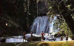
Most trips into Saint Elizabeth start at the falls, and there is nothing wrong with that. You park, you climb onto a tractor-drawn jitney, and you roll through working pasture with cattle grazing either side before the canopy closes overhead and the sound of water takes over. Seven tiers drop through the gorge, some cascading into shallow pools you can wade, others deep enough for a proper swim once you have tested the current.
The estate has run the site with an emphasis on keeping the grounds natural rather than paving everything flat, and you feel it in the cold shock of the spring water and the shade along the banks. What you can actually do once inside, from ziplining to the pools themselves, sits on our Things to Do page, and the natural history behind the cascades is on the Nature Guide. Admission and opening arrangements change with the season, so check the Plan Your Visit hub for current figures before you set out.
The Breadbasket Parish
Farming built Saint Elizabeth and still defines it. Tomatoes, scallions, sweet peppers, melons, yams, pimento and ginger move out of here to markets across the island and beyond, grown on smallholdings and larger estates that sit side by side along the valley roads. The Saturday market in Santa Cruz is the place to see it happening, with produce stacked in crates and prices argued over in the open air.
Middle Quarters deserves its own mention. The pepper shrimp sold from roadside stands along the Black River road are cooked in a spiced broth, scooped into paper and eaten with the fingers, and they have been a fixture on this stretch for longer than most visitors have been alive. Stop on the way back from the falls. You will smell the stands before you see them.
Bauxite: The Industry That Shaped the Interior
Alumina mining changed the parish’s interior in the second half of the twentieth century, and the refinery at Nain remains a major employer. The industry brought rail lines, roads and wages into hill communities that had relied on farming alone, and it left a complicated legacy that residents still talk about plainly. Mining and agriculture share the landscape here in a way that few visitor brochures mention, and understanding that tension goes a long way towards understanding the parish.
You will see the red earth and the settling ponds on the drive towards the falls if you come from the Mandeville side. Current operations and community programmes are best checked through the Jamaica Information Service and the island’s main newspapers, including the Jamaica Gleaner, which covers the sector closely.
Treasure Beach and Community Tourism
The four villages that make up Treasure Beach have built a tourism model that looks nothing like the north coast. Guesthouses are small and locally owned, restaurants are family-run, and the beach is a working fishing bay as much as a place to swim. Jake’s has been the anchor property here for decades and remains the reference point for anyone booking the area; the official site is at Jake’s Hotel.
The Calabash International Literary Festival put this coast on the cultural map, and the Breds Foundation, founded by the same family, has funded sports fields, scholarships and community projects across the villages. If your Jamaica trip is about avoiding the resort bubble, this is the coast where that actually works. Details of festival dates and community programmes are at the Calabash Festival site.
Accompong and the Maroon Story
Accompong sits on the parish’s north-eastern edge, in the Cockpit Country hills, and it is one of the best-documented Maroon settlements in Jamaica. The Leeward Maroons signed a peace treaty with the British in 1739 that recognised their autonomy, and that agreement still underpins the community’s identity today. The annual observance on 6 January draws visitors from across the island and from abroad.
Treat a visit as a cultural encounter rather than a photo stop. Go with a guide, buy from local vendors, and listen. The history here is not a display case. It belongs to the people standing in front of you.
Appleton Estate and the Rum Corridor
The Nassau Valley, north of Black River, has been rum country since the eighteenth century. Appleton Estate still distils there and runs a visitor experience with tastings and a look at the ageing warehouses, and the drive through the valley itself is worth the journey even if you skip the tour. Check current opening hours and booking requirements directly at Appleton Estate.
A distillery visit and a falls swim work well in the same day if you plan the order sensibly, and the sequencing options are set out on our combined South Coast itineraries page. Doing the rum first and the cold water afterwards is the version I recommend to friends.
The Supporting Cast of Attractions
- Bamboo Avenue — a stretch of road near Lacovia where giant bamboo arches overhead, planted in the eighteenth century
- Lover’s Leap — cliff-top viewpoint south of Junction with a steep drop and a long legend attached
- Floyd’s Pelican Bar — a wooden shack built on a sandbank offshore, reached by boat from Treasure Beach
- Font Hill — protected beach and wetland area west of Treasure Beach, good for birdwatching
- Maggotty Falls — smaller cascades near the YS road, quieter and far less visited
- Junction and Lacovia markets — roadside produce, pepper shrimp and cold drinks
Landscape, Weather and When It Goes Wrong
Jamaica’s hurricane season runs from June to November, with the highest risk between August and October. Rain arrives in two broad peaks, one around May and another through September and October, and the parish’s north gets far more of it than the south. That rainfall feeds the falls, which means water volume changes through the year. In a heavy wet season the cascades run fuller and faster; in a long dry spell the flow drops and some pools lose depth.
After a serious storm, sites on the south coast can close for days while crews clear roads and inspect the grounds. Check the operator’s own channels and the Jamaica Tourist Board before travelling, rather than trusting a cached blog post. Our Best Time to Visit page sets out the seasonal patterns in more detail.
Planning the Parish Into a Jamaica Trip
Two to three days is the realistic allowance for Saint Elizabeth if you want the falls, the river and the coast without spending your whole holiday in a minibus. Base yourself at Treasure Beach or Black River for the coastal end, and treat Santa Cruz or Mandeville as a splash of hill country if you want cooler nights.
| Route | Approximate driving time |
|---|---|
| Montego Bay to Black River | 2h 15m |
| Negril to Black River | 1h 30m |
| Negril to YS Falls | 1h 45m |
| Black River to YS Falls | 40m |
| Treasure Beach to YS Falls | 1h |
| Kingston to Black River | 3h |
Many visitors end up booking a guided run from Negril or Montego Bay because the drive involves hill roads and a fair amount of local navigation. That works well, and the trade-offs between self-driving and joining a tour are covered properly on the tickets and tours hub. Booking ahead makes sense in high season, particularly for combined falls and river itineraries, since seats fill quickly and cancellation terms differ sharply between platforms.
One last thing worth knowing: the parish is the section of Jamaica most visitors base themselves in without realising it. So many people sleep in Negril, drive through Westmoreland and spend the day in Saint Elizabeth, then fly home convinced they have seen the south coast. They have seen a corner of it.
From the postbag
“We booked the South Coast run mainly for the falls, and the drive up through the Pedro Plains turned out to be the part we kept talking about. Dry as a bone, then green as anything once you climb towards Maggotty. Our driver stopped at a shrimp stand near Middle Quarters and that was lunch sorted.”
— Hannah and Pete, Bristol, February
Where to Go Next
The falls are the easy part. The parish is the reward for staying a bit longer, driving a bit further, and letting the south coast set its own pace. Start with the logistics, then build the days around them.